Geolantis.360
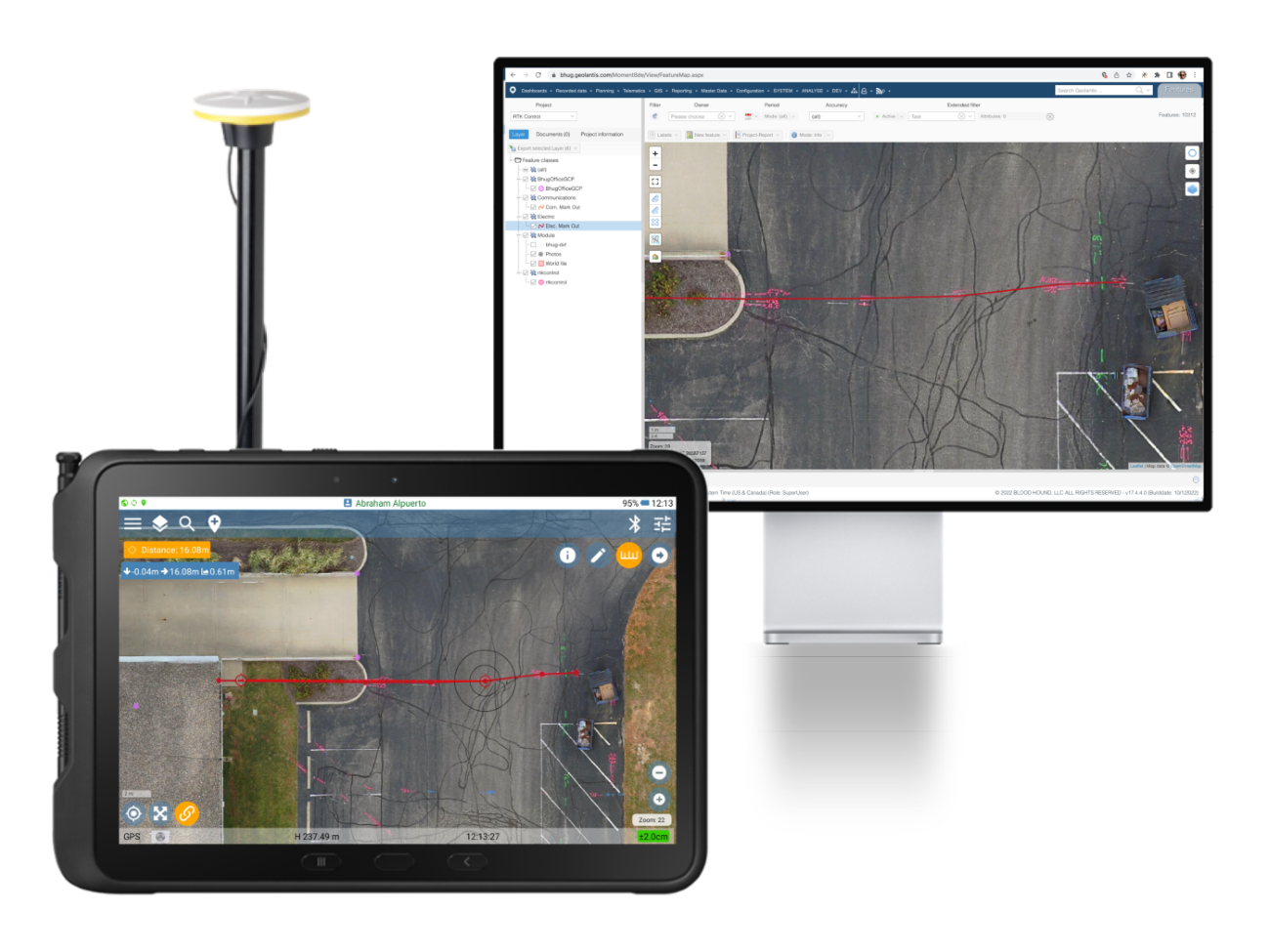
Geolantis.360 is a utility mapping software that transforms your standard mobile device into a powerful tool for capturing, recording, and visualising essential utility and infrastructure data. It offers unmatched speed and precision in mapping buried utilities such as cables, pipes, ducts, and drainage routes, all enriched with comprehensive metadata on type, depth, and cover.
Geolantis.360 simplifies subsurface utility mapping without requiring specialised equipment like total stations. It integrates effortlessly into existing processes and workflows, enabling your team to adopt it with minimal downtime. By leveraging RTK GNSS technology, Geolantis.360 delivers centimetre-level accuracy in data collection, providing precise and reliable documentation.
Ultimately, Geolantis.360 allows users to visualise and communicate where utilities are in the real world compared to a “paper world” and allows stakeholder groups to easily record and share metadata such as pipe size, material, temperature range, vendor, etc.
Request a demo today!