)
)
OS Data Insight and Services for GIS & CAD
At MGISS, we believe the real value of OS NGD lies in what you can do with it when you connect it to the data your organisation already holds. Internal asset registers, customer databases, maintenance records, compliance logs, operational workflows — these datasets become exponentially more powerful when they are spatially referenced against an authoritative national framework. The result is not a better map. It is automated risk assessment, scalable constraint analysis, repeatable proximity modelling and derived insight products that support decisions at every level of an organisation.
The organisations extracting the greatest return are those who are clear about the insight they need before they request the data to deliver it — defining the output first, then identifying which datasets, combined in which way, will get them there. That shift in thinking — from data acquisition to intelligence design — is where the real value is unlocked.
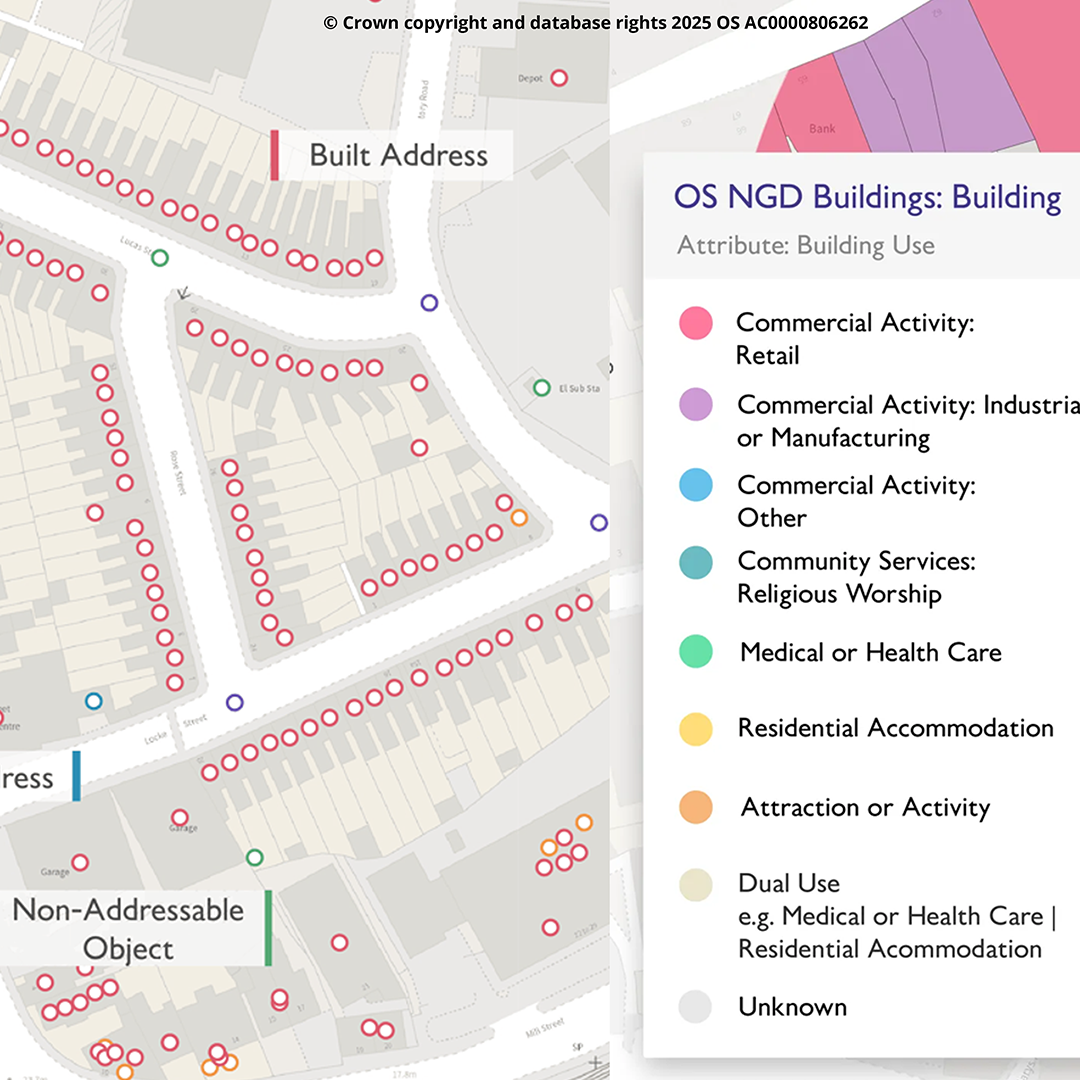
MGISS also offer a suite of specialist OS data products and OS data services that leverage the intelligence and rich visualisation within the Ordnance Survey National Geographic Database (NGD), Opendata stack and associated contextual mapping products to optimise the value of location data and hidden insight, for critical services and infrastructure, ultimately serving the needs of society in tackling some of the biggest challenges facing us all. MGISS work with all aspects of OS data, including UPRN data.
Focusing on flexibility, performance, and precision, we help customers extract maximum value from Ordnance Survey data—across field, office, and enterprise systems.
- Vector Tile Packages
- ETL Services
- Geoprocessing Tools for filtering, feature extraction, and cookie-cutting datasets to fit exact project needs
- Caching for Web & Mobile
- NGD (National Geographic Database)